
by Hayden Green | 2020202020202020 JulJul ThuThu | Press Release
Accurate differential GPS measurements for each image allow you to achieve centimetre level accuracy for aerial surveys even without GCPs, which greatly reduces field work and time. Normally it requires the use of a ground-based reference station together with a rover...
by Hayden Green | 2020202020202020 JunJun SatSat | Press Release
Over the past decade, the process of creating accurate 3D maps and models from drone photos has come a long way. Drone capture capabilities and photogrammetry processing software and services have improved in cost and efficiency to a point where 3D digital...
by Hayden Green | 2020202020202020 AprApr WedWed | Press Release
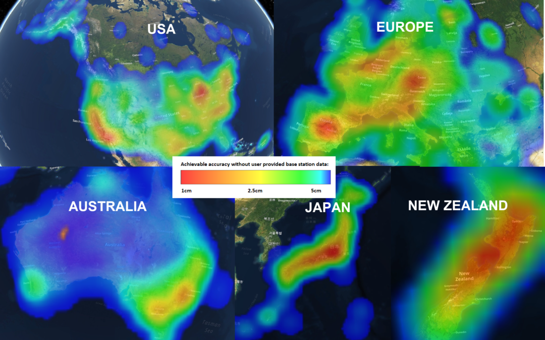
Klau Geomatics is now launching MakeItAccurate, a revolutionary new global GNSS data correction and processing service. MakeItAccurate takes data from any GNSS receiver on your drone or survey equipment and makes it accurate. You can now achieve cm level accuracy...

by Hayden Green | 2020202020202020 MarMar MonMon | Press Release
Enterprise operations adopting geospatial technology require high accuracy in their digital twins to make them a viable alternative to the real world for measurement and inspection. The challenge is to achieve accuracy with one simple, repeatable, scalable...
